Shoreline Permitting for South Puget Sound Homeowners Key Rules Permits and Tips

Building near the water is different from building almost anywhere else. On South Puget Sound, even a small project like replacing a bulkhead, adding stairs to the beach, expanding a deck, or clearing vegetation can trigger shoreline rules.
That can feel frustrating at first. The good news is that shoreline permitting follows a pattern once you know what agencies care about, what permits may apply, and where projects most often get delayed.
This guide gives homeowners a practical overview of the rules, permits, environmental issues, and planning steps that shape shoreline projects in South Puget Sound. It is informational only and not legal advice. For a specific property or project, confirm requirements with the local planning department and qualified professionals.
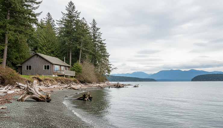
South Puget Sound shoreline rules start with location
The first question is not what the project is. It is where the project sits in relation to the shoreline, tidelands, wetlands, steep slopes, streams, and flood hazard areas.
Most shoreline properties in Washington are governed by a mix of state, local, and sometimes federal rules. South Puget Sound homeowners often deal with several layers at once.
The Shoreline Management Act shapes local rules
Washington’s Shoreline Management Act is the main state law behind shoreline regulation. It requires cities and counties to manage shoreline areas through a local Shoreline Master Program, often called an SMP.
The SMP sets rules for work near marine waters, lakes, larger streams, and associated wetlands. It may affect:
New homes
Home additions
Decks, patios, and stairs
Bulkheads and other shoreline armoring
Docks, floats, and mooring structures
Tree removal and vegetation clearing
Grading, fill, and excavation
Stormwater systems
Septic work near the shoreline
The shoreline jurisdiction often extends landward from the ordinary high water mark, but the exact reach can vary depending on local rules, wetlands, floodplains, and other site conditions. That is why a survey, site plan, and early zoning review matter.
Local critical areas rules may also apply
Shoreline permits are only part of the picture. Counties and cities also regulate environmentally sensitive areas under critical areas ordinances.
A waterfront property may include or sit near:
Wetlands
Fish and wildlife habitat areas
Geologically hazardous slopes
Frequently flooded areas
Streams or drainage corridors
Erosion-prone bluffs
Critical areas rules can require buffers, setbacks, studies, or mitigation. On some properties, these rules drive the design more than the shoreline code itself.
Private property rights still come with limits
Owning shoreline property does not mean every part of the beach or tideland can be built on freely. Property boundaries, tideland ownership, access easements, public trust interests, and navigation rules can all affect what can be built.
Before planning work near the water, review the title report, survey, shoreline designation, and any recorded easements or covenants. This can prevent an expensive redesign later.
The permits homeowners may need
There is no single “shoreline permit” that covers every project. A simple repair may need one local approval. A dock, bulkhead, or overwater project may involve several agencies.
The permits below are common in shoreline permitting for South Puget Sound homeowners, though not every project will need all of them.

Local shoreline approval
Local governments administer shoreline permits under their Shoreline Master Program. Depending on the work, a project may require one of several approval types.
Permit or approval | When it may apply | What reviewers look for |
Shoreline exemption | Smaller projects or repairs that meet exemption criteria | Whether the work truly qualifies and still follows shoreline rules |
Shoreline substantial development permit | Larger development or work over certain thresholds | Use, scale, impacts, public access, setbacks, and consistency with the SMP |
Shoreline variance | Work that does not meet dimensional standards | Hardship, minimum necessary deviation, and impacts |
Shoreline conditional use permit | Uses allowed only with extra review | Compatibility, public interest, and special conditions |
A project can be exempt from a shoreline substantial development permit and still need other approvals. “Exempt” does not mean “unregulated.”
Building, grading, and clearing permits
If the project includes construction, excavation, tree removal, retaining walls, foundation work, or drainage changes, local building and site development permits may apply.
Common examples include:
Building permits for additions, decks, stairs, and foundations
Grading permits for excavation or fill
Tree or vegetation removal permits
Stormwater review
Floodplain development permits
Septic permits or health department review
For homes on bluffs or steep slopes, geotechnical reports are often required. These reports help show that the project will not increase erosion, landslide risk, or drainage problems.
State permits for work in or near the water
Projects that touch the beach, bank, or water often need state review.
A key permit is the Hydraulic Project Approval, often called an HPA, from the Washington Department of Fish and Wildlife. It applies to work that uses, diverts, obstructs, or changes the bed or flow of state waters. In practical terms, many bulkhead, beach, dock, culvert, and nearshore projects may trigger HPA review.
Other state approvals may apply through the Washington Department of Ecology, especially if the project affects water quality, wetlands, or requires federal coordination.
Federal permits for docks, fill, and navigable waters
Federal permits may be needed when work affects navigable waters, wetlands, or waters of the United States.
The U.S. Army Corps of Engineers is commonly involved with:
Docks and piers
Pile installation or removal
Fill below certain water lines
Work in wetlands
Shoreline stabilization projects
Dredging or excavation in regulated waters
Some federal permits also require state water quality certification. If endangered species or cultural resources could be affected, review may take longer.
The JARPA form can help coordinate review
Washington uses a Joint Aquatic Resources Permit Application, commonly called JARPA, for many aquatic projects. It helps route information to multiple agencies.
A JARPA does not replace all local forms, studies, or drawings. Still, for in-water or overwater work, it can reduce duplicate paperwork and help keep agency review aligned.
Common challenges that slow shoreline projects
Many shoreline permitting problems are avoidable. The hard part is that they often show up after a homeowner has already paid for design work.

The ordinary high water mark is unclear
Many shoreline rules measure from the ordinary high water mark. On a natural beach, that line is not always obvious. Guessing can create major permit problems.
A qualified surveyor or shoreline professional can help identify and map the line. For work close to the water, this is often one of the best early investments.
The project conflicts with buffers or setbacks
Shoreline buffers and setbacks vary by jurisdiction, shoreline designation, habitat conditions, and project type. They may also overlap with critical area buffers.
If a proposed addition or patio extends into a buffer, the local government may require redesign, mitigation, a variance, or denial. Starting with a constraints map helps avoid designing in the wrong place.
Existing structures were built without permits
Older waterfront properties sometimes include unpermitted stairs, decks, walls, sheds, fill, or beach access paths. When new work is proposed, the local jurisdiction may ask about the status of what already exists.
This can complicate the project. Gather old permits, tax records, surveys, and photos before applying. If something lacks documentation, ask the jurisdiction how to address it before submitting a full application.
Shoreline armoring is harder to permit
Bulkheads and hard shoreline armoring receive close review because they can affect beach processes, sediment movement, forage fish habitat, and neighboring properties.
Many agencies now prefer softer approaches where feasible, such as:
Beach nourishment
Large wood placement
Native vegetation
Bank regrading
Setback or relocation of vulnerable structures
Soft shore protection designed by qualified specialists
A new bulkhead may need analysis showing it is necessary to protect an existing primary structure, not just to create a larger lawn or stop normal beach change.
Timing windows can limit construction
In-water work often must occur during approved fish windows. These windows protect salmon, forage fish, shellfish, and other aquatic life during sensitive periods.
Even if permits are issued, the permit conditions may restrict when construction can happen. Build this into the schedule early, especially if the project also depends on tides, contractor availability, and dry weather.
Environmental considerations should shape the design
A successful shoreline project does more than pass review. It works with the site.
South Puget Sound shorelines support eelgrass beds, forage fish spawning areas, shellfish habitat, salmon migration corridors, marine birds, and nearshore vegetation. They also face erosion, sea level rise, stronger storm events, and water quality pressure from upland development.
Keep natural shoreline functions intact
Agencies often focus on whether a project causes “no net loss” of shoreline ecological function. In plain language, the project should avoid harming shoreline processes and habitat. If impacts cannot be avoided, it may need mitigation.
Good design choices include:
Keeping structures as far landward as practical
Preserving native trees and shrubs
Avoiding unnecessary fill or grading
Reducing impervious surfaces
Managing runoff before it reaches the beach
Using pervious paths or small-footprint access routes
Limiting lighting that spills onto the water
Avoiding treated wood where water contact is possible
Plan for erosion without overreacting
Erosion is not always a problem to “fix.” Some beach movement is natural and helps maintain habitat. The right response depends on the site.
A bluff property may need drainage control and vegetation management more than a wall. A low-bank property may need flood-resistant design, setbacks, or beach-friendly stabilization. A qualified coastal geologist, engineer, or habitat biologist can help identify the least damaging option that still protects the home.
Treat stormwater as a core design issue
Runoff from roofs, driveways, patios, and compacted lawns can carry pollutants to the Sound and increase erosion on slopes.
Best practices include:
Directing roof runoff away from bluffs and steep slopes
Using rain gardens where soils allow
Choosing permeable paving when appropriate
Maintaining native vegetation between the home and shoreline
Avoiding fertilizer and pesticide use near the water
Inspecting drainage outlets regularly
Stormwater details may look minor on plans, but they can make or break a shoreline review.
Practical tips for a smoother permitting process
Permitting is rarely fast, but it can be predictable. The strongest applications are clear, complete, and realistic about site constraints.
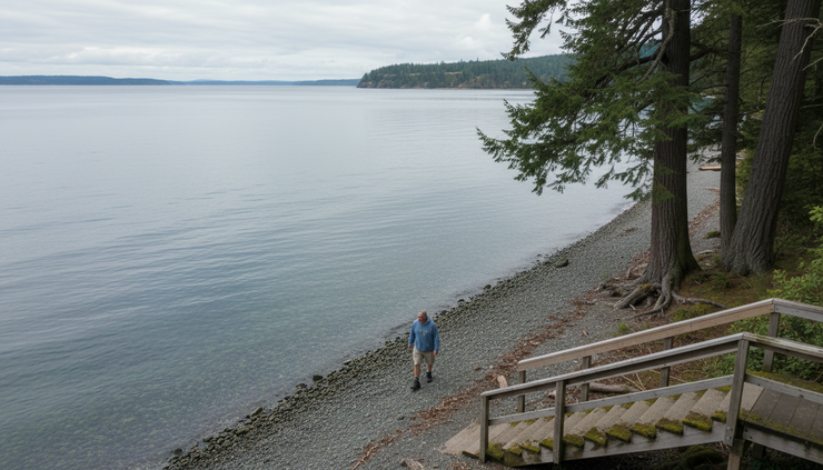
Start with a pre-application conversation
Most local planning departments offer some form of early guidance. A pre-application meeting can identify zoning issues, shoreline permits, critical areas review, required studies, and likely agency involvement.
Bring a basic site plan, photos, a project description, and known property documents. The goal is not to get final approval. The goal is to learn what path the project will follow.
Build the right team early
For small projects, a contractor and local planner may be enough. For more complex shoreline work, the team may need:
A surveyor
A civil engineer
A geotechnical engineer
A wetland or habitat biologist
A coastal engineer or coastal geologist
A septic designer
An architect or designer familiar with shoreline rules
Hiring the right specialist after an application stalls usually costs more than involving that person at the start.
Ask these questions before design begins
Before committing to a design, answer the basics.
Where is the ordinary high water mark?
What is the shoreline designation?
Are there wetlands, streams, steep slopes, or flood zones?
What buffers and setbacks apply?
Is the site served by septic or sewer?
Does the project involve beach, bank, or in-water work?
Will the project need state or federal review?
Are there seasonal construction limits?
Are there old permits for existing shoreline structures?
These answers shape the budget, design, and timeline.
Submit a complete and consistent application
Incomplete applications cause delays. Conflicting drawings cause even longer delays.
Make sure the application materials tell the same story. The site plan, narrative, construction drawings, technical reports, and mitigation plan should match. If the project avoids impacts, explain how. If it creates impacts, explain how those impacts will be reduced and mitigated.
Helpful materials often include:
A clear project narrative
Existing and proposed site plans
Photos from the beach, upland, and side property lines
Surveyed shoreline features
Construction access and staging plans
Erosion and sediment control plans
Stormwater details
Planting or mitigation plans
Technical reports when required
Keep communication organized
Agency reviewers handle many projects. Clear communication helps.
Use brief emails, respond to correction letters point by point, and keep a record of submittals. If several agencies are involved, track permit numbers, contacts, review status, and conditions in one place.
When comments seem unclear, ask for clarification before revising plans. A short call can save weeks of back-and-forth.
A good shoreline project respects both the home and the Sound
Building on South Puget Sound shoreline property takes patience, but the process has a purpose. The rules protect homes, neighbors, public waters, fish habitat, and the natural systems that make waterfront living valuable in the first place.
The best path is simple: learn the site constraints early, design around them, involve the right professionals, and submit a complete application. A project that fits the shoreline will usually move more smoothly than one that fights it.


Comments